A long, twisty road marks the south exit of Zion Canyon. Tourists on e-bikes litter the sidewalks and road shoulder. Teetering side to side, they threaten to wander haphazardly into the road. Between near misses, even the most careful driver flicks her eyes to the jagged horizon. She can’t help but wonder what is over there in the Canaan Mountain Wilderness.
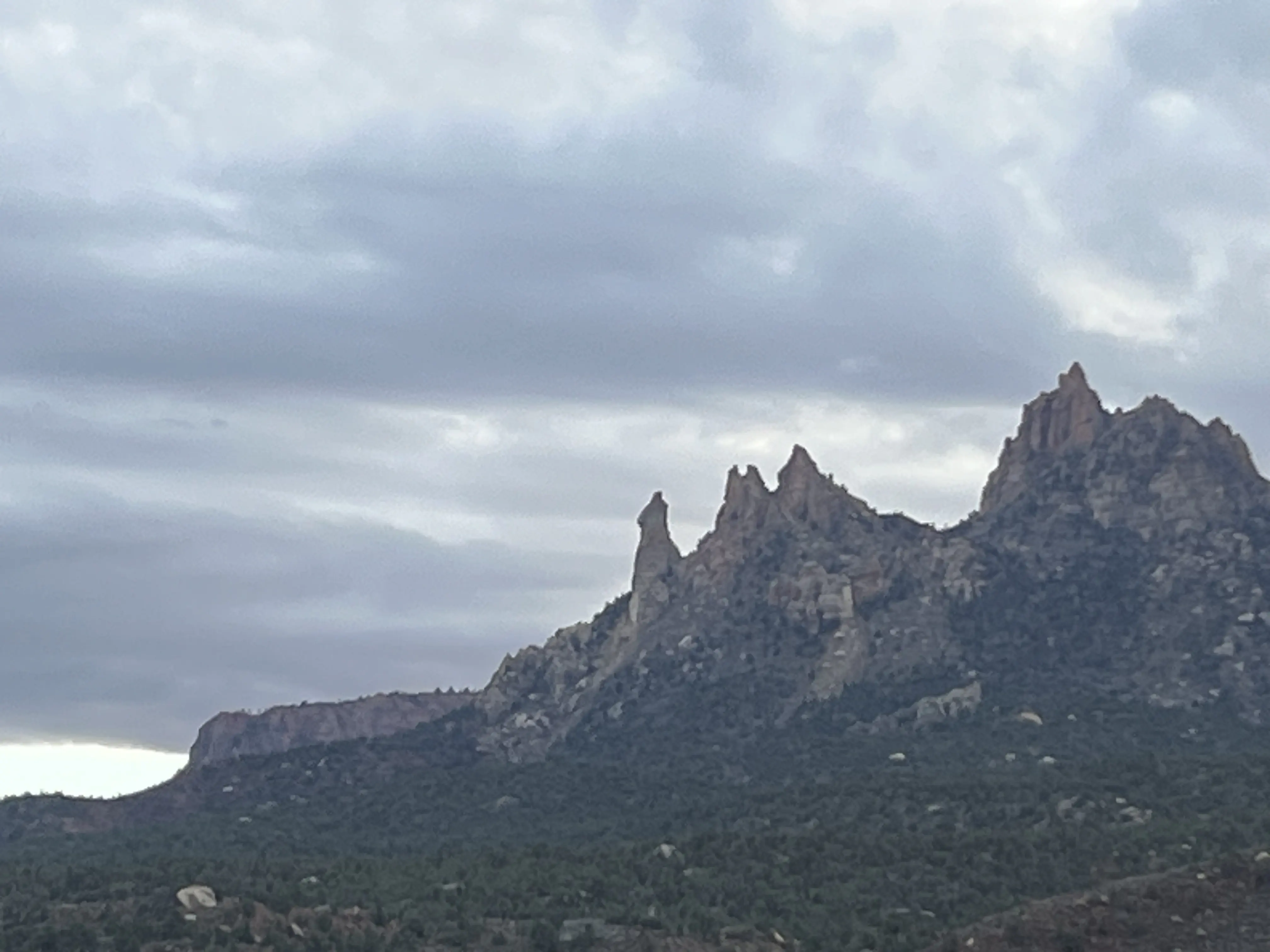
These saw-tooth spires are the Eagle Crags. Mrs. Butterworth, named for the tower’s stark resemblance to the syrup bottle’s silhouette, stands proudly apart from the rest. It’s pictured as the left-most peak in the following photo:
A couple days ago, my dad and I climbed it. The challenge that we met follows.
Directions
Trailhead: 37.14751, -113.03108
Driving through Rockville, turn south onto Bridge Road. Respect the locals by driving slowly here. Follow the road over a single-lane bridge that crosses the Virgin River. Where the road turns sharply right a couple hundred yards later, continue south onto a road which quickly becomes dirt, marked by a sign which says, “LOCAL TRAFFIC ONLY”. Along this road, there are many signs deterring trespassers. Do your best not to split from the main dirt road and drive up someone’s driveway, but don’t be dissuaded by the signs. After about a mile on this rough dirt road, cross a cattle guard after a sharp left turn. Another half mile later, the Eagle Crags Trailhead appears on the right.1
We took our old F250. The stiff suspension nearly rattled our teeth out on the bumpy dirt road, but we would have struggled to make it without 4-wheel drive.
Approach
Bottom of the first pitch: 37.12895, -113.00859
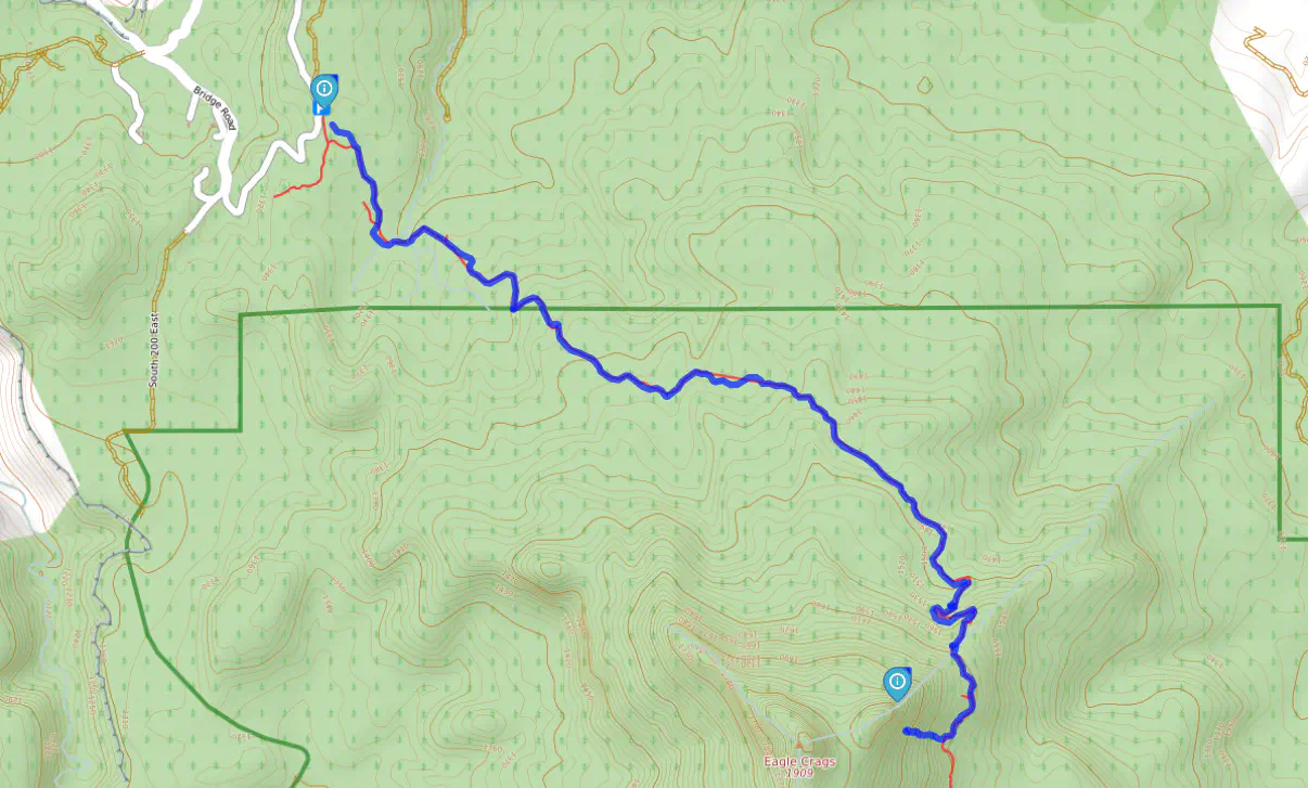
From the trailhead, the approach follows the Eagle Crags Trail for nearly three miles. The trail follows a gradual incline which gets steeper as it snakes its way around the east side of the crags. Don’t be tempted to leave the trail to cut straight to the tower until a couple hundred yards after the top of the switchbacks. Going around the far side of the tower makes for a longer approach, but it goes easier.
Once you’ve rounded the east side of the tower, leave the trail to make a break for the bottom of the first pitch on the south-west face of the tower. My dad and I saw a social trail leaving the main trail at this point. You may or may not see the same offshoot depending on how much traffic that small social trail sees.
At this point, my dad and I wandered around the north side of the tower. We had to be careful not to trundle rocks on each other. On the descent (which is pictured in the map), we went around the other side. It’s equally steep, but has fewer loose rocks and more signs of travel. Either way is 3rd class scrambling. I recommend the south side of the tower.
Protection
We brought each of our quad anchors, a set of nuts, two full racks of cams (BD #0.3 to #3), a couple slings for extension, and a 70 meter rope. We stuck our rope in a crack on the first rappel of the descent. Bring a knife and a prusik in case the same happens to you. Luckily, we were able to pull our rope loose before we seriously considered rope surgery.
The short pitch lengths allowed us to place plenty of pro without risk of running out of options. We probably could have gone with a thinner rack.
The Climb
I led the first pitch. It’s an easy, fun fingers and hands crack. It eventually gives way to 4th class climbing about halfway up, during which I didn’t bother placing pro. A tree with a cordelette anchor marks the top.
My dad led the second pitch. It starts out easy, but about halfway up, it becomes much more cruxy at a finger-width crack in a bulge that kicked my butt. Shameless hang-dogging here. Two bolts were our prize at the top.
After we caught our breath at the bottom of the third pitch, I led the final pitch. It begins with a tough mantle over the Crevasse of Death. Pretty easy climbing afterwards until a challenging move before the bolts at the top.2
We finally made it.
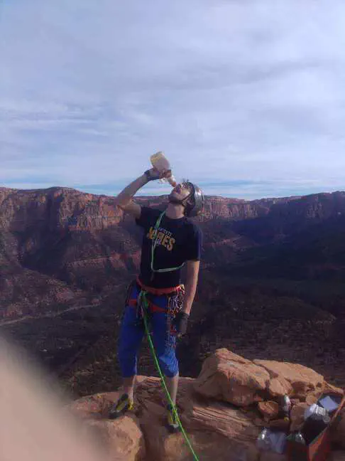
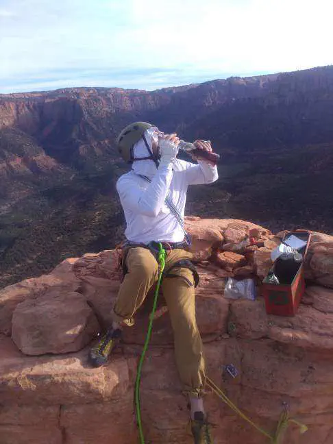
We celebrated with some syrup and immortalized our ascent in the sticky log book which now reads, “I love my dad.”
Directions to Eagle Crags Trailhead and more information on the trail are available on the BLM website: https://www.blm.gov/visit/eagle-crags-trail ↩︎
More accurate and up-to-date information on the route may be found on Mountain Project: https://www.mountainproject.com/route/105976912/tooele-tower ↩︎